
Reeds can provide habitat and useful material while also affecting access and water movement. Deciding what to retain, harvest or remove requires a view of the river, its floodplain and the people living downstream. A photograph of dense vegetation is a starting observation, not a complete flood assessment.
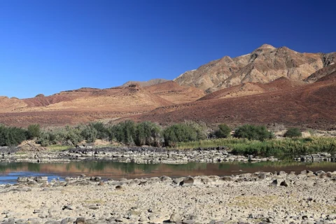

From the Namibian discussions
A lively Namibian discussion connected reeds with flooding around Mariental and along the Orange River. Participants also raised nutrient inputs, settlement on floodplains and dam operations. The different views are worth preserving: they point to interacting causes rather than establishing that one intervention will solve every flood problem.
Separate observations from explanations
Record where vegetation is growing, whether it is changing and what people actually saw during a flood. Keep dated photographs from safe fixed points. Distinguish a measured blockage at a structure from a general impression that the river has become overgrown.
Ask longer-term residents about earlier channels, floods and harvesting practices. Mark these as recollections unless supported by records. Collecting several accounts can reveal useful patterns, but agreement alone does not quantify how much a particular factor changed the flood level.
Read the river as part of a catchment
A local reach receives water and sediment from upstream and passes them onward. Rainfall, channel shape, bridges, floodplain occupation, vegetation and reservoir operations can all affect risk. Removing plants at one point can change conditions elsewhere; a local improvement should not be assumed to benefit every downstream neighbour.
Use available flood maps and responsible water-management authorities to establish the planning context. The Mariental integrated-water project documented by DRFN is an example of community assessment and planning across several water needs. Its existence does not establish the cause of a specific flood.
Define the purpose before choosing the work
Be precise about the objective: keeping an approved access point usable, maintaining a structure, harvesting material or reducing an assessed flood hazard. Each needs a different scale of work and different evidence. A vegetation map, photographs and a list of affected people make a discussion more useful than a general call to clear the river.
Ask who is responsible for the reach and what assessment and permissions are needed before changing the channel or banks. Check species identity rather than assuming every tall waterside plant is the same reed. Include habitat, bank stability and downstream effects in the decision.
Consider maintenance and sources of regrowth
If a qualified assessment supports selective work, specify the location, method, access route, handling of cut material and follow-up. Loose cut vegetation left where it can wash into a bridge opening may create another problem. Do not burn, poison, dredge or drive heavy machinery into a river as an informal experiment.
Where nutrient enrichment is suspected, investigate the source rather than treating rapid regrowth as only a cutting problem. Discuss wastewater, runoff and other inputs with the relevant authorities. The cause needs evidence; a green patch alone does not identify a polluter.
Keep people safe and review the outcome
- Observe from safe ground; do not enter flowing floodwater to take measurements.
- Keep homes, gardens and critical equipment out of known flood pathways where possible.
- Use official warnings and agreed communication routes during high-flow events.
- Compare the agreed project objective with the result and any new downstream effects.
A community can contribute valuable photographs, historical knowledge and maintenance observations without taking on an unassessed engineering project. Store the observations in one accessible record so each new meeting does not start again from memory.
Namibian climate and microclimate
Namibia’s rivers can remain dry or quiet for long periods and then carry powerful flows. Conditions at the observation point do not describe rainfall far upstream. Irrigation, persistent pools and nutrient-rich water also create wetter microhabitats within an otherwise arid landscape.
Your first practical step
Choose one safe observation point and assemble dated photos, local accounts and a catchment map. Bring a clearly stated question to the responsible water or municipal team.
Watch and adapt
 Watch videoWatch: How (and why) to FIND YOUR WATERSHED
Publisher: Andrew Millison
Country and context: Exact filming country not confirmed.
A watershed-reading lesson. Use Namibian maps to locate your own catchment and confirm local drainage on foot where safe.
The watershed lesson helps explain upstream and downstream connections. It is not a reed-clearance design or a prediction of flooding at Mariental.
Keep exploring
- Rainwater Harvesting in Arid Regions: Practical Solutions for Water Security in Southern Africa
- Irrigation water quality: understand the test before planting
- Invasive Species in Namibia – Threat or Opportunity?
Sources and further reading
- DRFN: integrated water-resource planning in Mariental
- ORASECOM: Namibia Environmental Action Plan, 2014—historical catchment context
Have you tried this in Namibia? Share the site conditions, method and result—including what did not work—with the Living Earth community. Local observations help the next person adapt the idea.