
A catchment is the area from which runoff drains toward a shared outlet. Seeing your garden or farm within that larger area helps you understand incoming water, erosion and the effects of changes on neighbours downstream.
.jpg)
From the Namibian discussions
A saved Namibian topic asked for river and catchment maps. The Atlas of Namibia and the Environmental Information Service provide a strong starting point. A national map can explain the wider system, but it is not detailed enough to position an earthwork or settle a property boundary.
Move from large scale to small scale
The Atlas of Namibia includes maps of rivers, catchments and the Cuvelai drainage system. Begin with the broad basin, then use more detailed mapping and field observation to understand the site. Seasonal channels can be important even when they are dry during a visit.
Make a first map
- Locate the property or settlement and identify the nearest drainage lines and downstream outlet.
- Mark higher ground, roads, culverts, existing ponds and places where runoff enters or leaves.
- Walk safe parts of the site after rain, noting sediment, erosion and overflow marks. Never enter flowing floodwater to verify a map.
- Compare observations with the map and mark uncertain sections for further checking.
Ask who else is connected
Runoff may cross several properties or serve users downstream. Discuss proposed changes with neighbours and the appropriate authority before blocking or diverting flow. Land access and water permissions are separate questions from whether an earthwork appears physically possible.
Use the map to choose the next investigation
A catchment sketch can guide a conversation with a surveyor or water professional. It cannot determine a safe dam height, spillway size or excavation design. Small household improvements also need a safe overflow route; a blocked drain can damage foundations even when the intended garden basin is small.
Namibian climate and microclimate
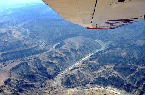
Ephemeral rivers can carry dangerous flows after rain far upstream. Flat northern drainage systems behave differently from steep rocky catchments. Satellite imagery taken in the dry season may hide the routes that matter most during a flood.
Your first practical step
Locate your broader catchment in the atlas and draw the visible water paths around one growing area. Keep the unknowns marked before planning any digging.
Watch and adapt
Watch: How (and why) to FIND YOUR WATERSHED
Publisher: Andrew Millison
Country and context: Exact filming country not confirmed.
A watershed-reading lesson. Use Namibian maps to locate your own catchment and confirm local drainage on foot where safe.
Use the watershed explanation to read connections across a landscape. It does not provide a Namibian engineering design or authorisation to divert water.
Keep exploring
- Rainwater Harvesting in Arid Regions: Practical Solutions for Water Security in Southern Africa
- Contour Farming
- Gabions & Check dams
Sources and further reading
Have you tried this in Namibia? Share the site conditions, method and result—including what did not work—with the Living Earth community. Local observations help the next person adapt the idea.